This series of images are what inspired my current project – Sinister Idyll. Sinister Idyll as a title came about from standing on the Best Farm property at the Monocacy National Battlefield monument outside Frederick, Maryland, and seeing the beautiful summertime landscape of rolling hills covered with cornfields, knowing the horrors of American slavery that were practiced on the property. At the end of the 18th century, the Vincendieres, a French Creole family fled to Maryland from Haiti to escape the slave revolts.
Headed by a woman, Victoire, they re-established their plantation life outside Frederick, Maryland, on a 750-plus acre property they called L’Hermitage. At their peak, they owned some 90 slaves. This was an extraordinary number – across the Potomac River, Oatlands plantation had 120 to work 3500 acres. It is not known why they had so many slaves as records of their business do not survive, and they may have been trying to cultivate labor-intensive crops such as tobacco. What is known, however, is that they were also operating a stud service – slave breeding for hire – and that their own methods for treating their slaves were harsh enough that the sheriff was called to their property multiple times by neighbors on complaints about cruelty and mistreatment of the enslaved population.

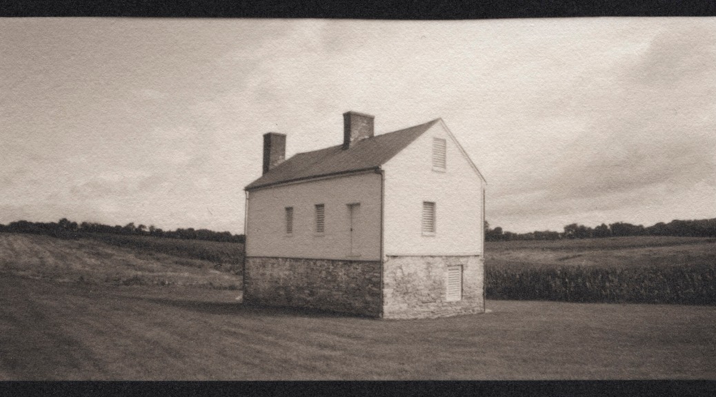
This building is the Bachelors’ House, a secondary dwelling for the young men of the family to live outside the main house until they married and started their own property and family. Today it presents an idyllic scene, but on the ridge behind it and to the right was the location of three slave cabins, each not much different in size to the Bachelors’ House, but housing roughly thirty people per structure.
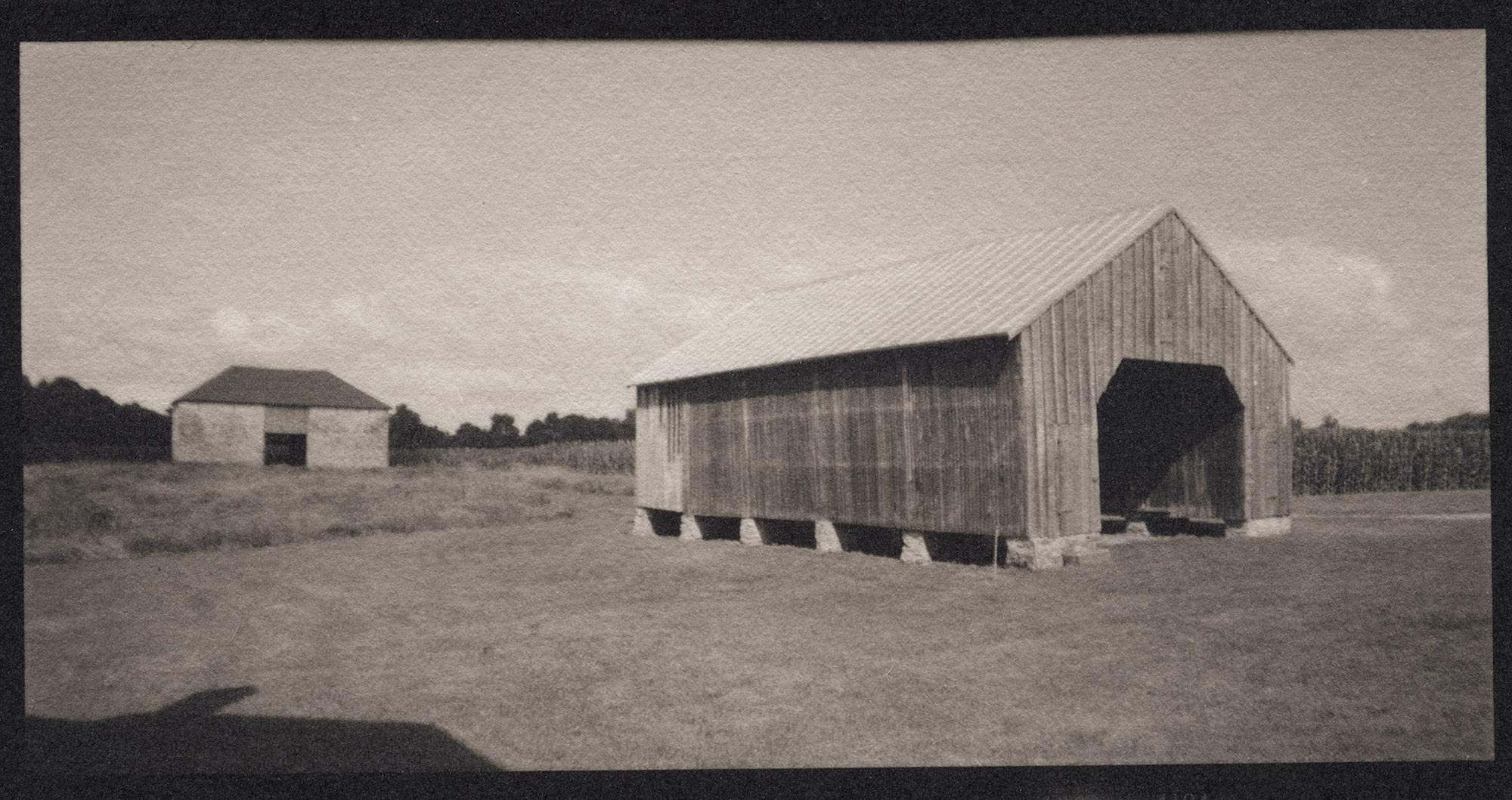
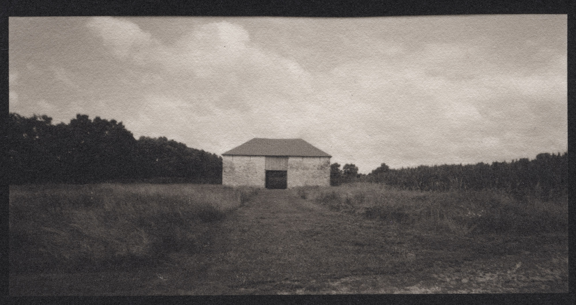
This is the corn crib on the Best Farm. It is called the Best Farm today, rather than L’Hermitage, because the last family to operate the farm was the Best family – they leased the land from 1863 into the 1990s. The corn crib is another site of slave labor in an otherwise bucolic landscape. The stone barn you can see in the background would have housed farm animals and machinery. It is a far better, more sound and protective structure than the cabins where the slaves would have lived. You can see the shadow of the big house intruding on the foreground, much as it would have loomed over the lives of all the enslaved population.
If the stone barn gives you echoes of northern France, you’d be correct – architecturally it is styled after the structures of the homeland of the Vincendiere family. It is one of the oldest stone barns in Maryland, if not in the US. There is a tremendous sense of irony that a structure styled after the home of freedom of thought and equality of mankind would be the site of barbaric enslavement. There is also a tremendous irony in such a property being operated in such a way by a woman in the first decades of the 19th century, when such things were highly anomalous at best.
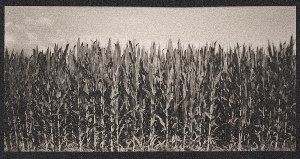
Today this field grows rich with corn. Clear blue skies and puffy white clouds cap the scene. In 1862, in this cornfield, a turning-point of the Civil War almost happened. Robert E. Lee’s army had camped here, on the march to Antietam. Left behind was a copy of General Orders #191, which detailed Lee’s plans. It was found wrapped around three cigars, abandoned in the camp. Delivered to General MacLellan, they practically handed him Lee’s army on a platter. As usual, MacLellan failed to follow up completely on this intelligence coup, and the end result was the single deadliest day in U.S. military history with some 22,000 dead, wounded or missing, and a war that would drag on for three more long, bloody years.
I have chosen to photograph these scenes in panoramic format because the wide aspect ratio emphasizes the landscape surroundings and provides a context for the structures and places. I purposefully chose to print them as very small contact prints to force intimacy with the subject – to view them you can’t hold yourself at a remove and distance yourself from the context – the echoes of slavery on this landscape are very much still with us if we stop for a moment to look and listen. I am printing them in palladium because the warm tone of the image evokes a certain historicity of the scene, reminding you that these hidden scars upon the landscape and the soul of the country are eternal.
My plans are to continue this project on locations throughout the Washington DC metropolitan area and expanding beyond as time and budget permit. Next up, Sully Plantation.
