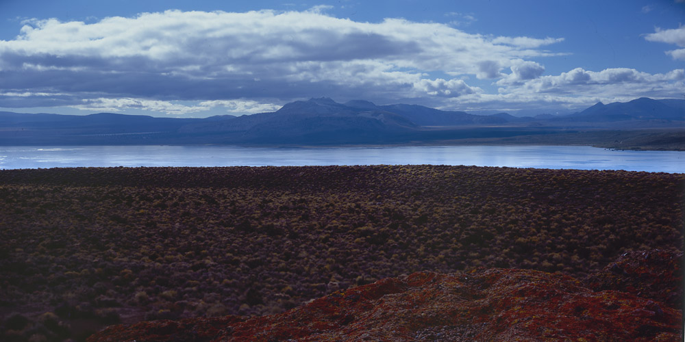
Another panorama taken from a 4×5 Fujicrhome transparency shot on my trip to the eastern Sierra. This view is from the north, looking down at the lake from the top of that volcanic upthrust where the fissures are that I mentioned in the previous post.
Mono Lake, from Upthrust
Mono Lake is like the Great Salt Lake in Utah or the Dead Sea in Israel – it has no natural drainage, so over time, the waters have become super alkaline with all the minerals that leach out of the rocks and soil around it. I wouldn’t drink it, and although you can swim in it if you’re so inclined, it’s not a pleasant feeling. The mineral content makes it such that it is easy to float on the surface – the ducks and other aquatic birds seem to float on top of the water, instead of in it. I have a few photos of the tufa formations for which the lake is famous that I’ll scan and post later. The tufas are formed when pure freshwater from underground springs enters the lake, causing the minerals in the water around it to sediment out and form hollow columns in fantastic shapes.
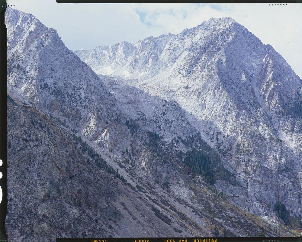
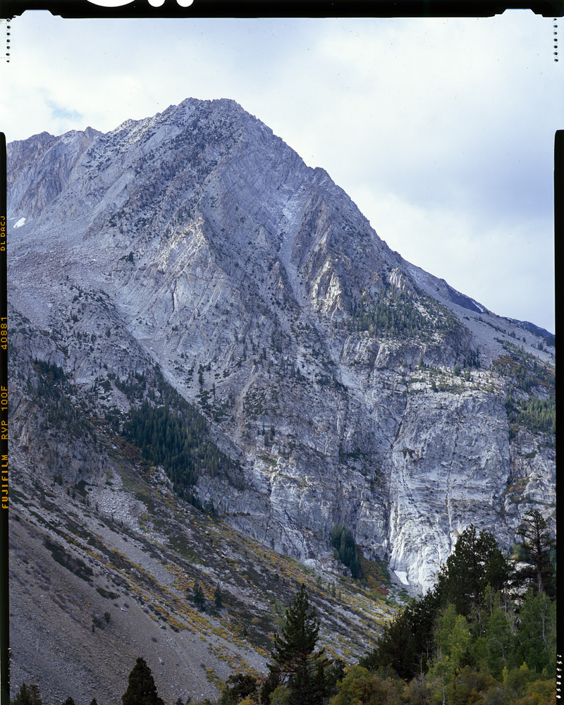
I was doing some clean-up in my library after doing the book inventory and came across something I’ve been looking for for a very long time: a box of 4×5 Fujichrome Velvia 100F transparencies (slide film). No scan on the internet will do the actual chromes justice – they need to be viewed on a lightbox with a loupe or even better, projected. Not that I have a projector that could handle a 4×5 chrome. But here are two favorites that I think come pretty close to conveying the majesty of a big slide:
Tioga PassTioga Pass
These are both views of the eastern end of the Tioga Pass, on the way in to Yosemite National Park from Lee Vining. If memory serves, these are even before you get to the ranger station at the park entrance. I took a vacation back in I think 2004 to the east side of the California Sierra. I drove from San Francisco up through gold rush country – Sutter Creek, Volcano, and Sonora to take 108 around the north side of Yosemite through the Sonora Pass to get to Lee Vining, where I eventually stayed for a couple nights to explore the landscape. Photographers, like fishermen, have tales of “the one that got away” – this is mine, “the shot I couldn’t take”. Coming up through the Sonora Pass, I reached the peak of the pass, 9980 feet of elevation, just at sunset. The road that climbs up through the pass becomes a series of hairpin switchbacks as it approaches the apex. Ascending the penultimate stretch, I glanced out the window to see the setting sun painting the mountain faces to the west brilliant oranges and reds, like they were on fire. There was no place to stop, even if I didn’t get out of the car, let alone set up a tripod and squeeze off a frame or two with a 4×5 field camera. So the image has to live in my memory, and hopefully in retelling it, I’ll encourage some of you to get out there and drive that route yourselves, and time your trip so that you climb the pass at sunset and can see it for yourselves.
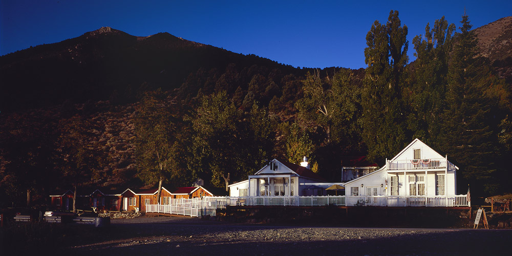
I’ll close with a panorama shot cropped from a 4×5 ‘chrome I shot of the Tioga Inn where I stayed. The two white buildings of the inn are actually salvaged structures in whole or in part from Bodie, the famous ghost town up the road a little ways. The more modern cabins on the left are some of the rooms – there are more cabins on the right, up in the trees, some of which are also made of Bodie salvage materials.
Tioga Inn
I’ll have more to tell of the road trip in future posts.