Category Archives: Landscapes

My Friend TC, at the Boboli Gardens, Florence

TC is a friend I’ve known for gosh, probably 10 years now. When we met he was a grad student working on his PhD at MIT. He’s now a full-fledged Doctor in Physical Chemistry, and working in Zurich. When I told him I was coming to Florence, he offered to pop down and hang out for a day or two. He was a real godsend, as I was still in the throes of a really bad allergy attack triggered by down pillows on the bed of my apartment in Rome, and he stopped at a pharmacy and got me some European Benadryl.

TC in the Boboli Gardens

We went to the Uffizi the first day I was in Florence, then grabbed dinner at a restaurant he found on Yelp. The food was quite good, but what shocked me was the size of the portions. I was used to these small portion sizes per course that I had been getting in Rome, so I had a pasta course, a salad, and an entree. The pasta wasn’t too much bigger than I was expecting, but the salad was entree- sized! I had only had maybe 1/3 of the salad when the waitress stopped by and asked about it. I told her it was very good but just too big. She offered to cancel my entree, which I was glad to accept. Half and hour later, we’re sitting chatting and the entree arrives after all!

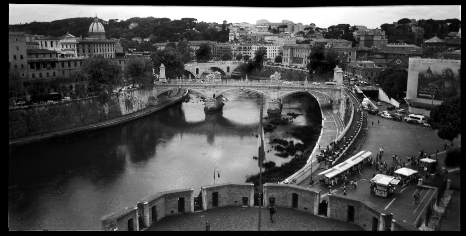
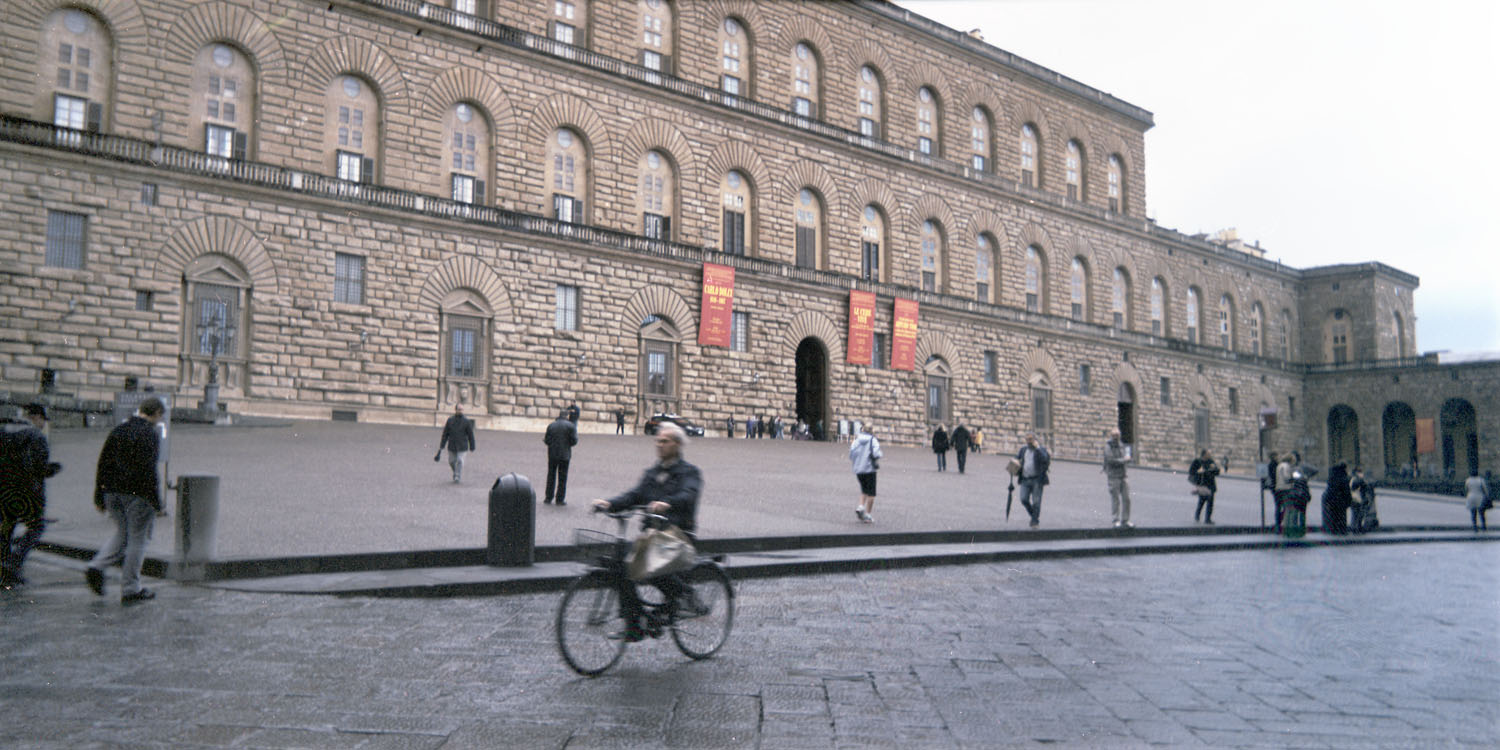
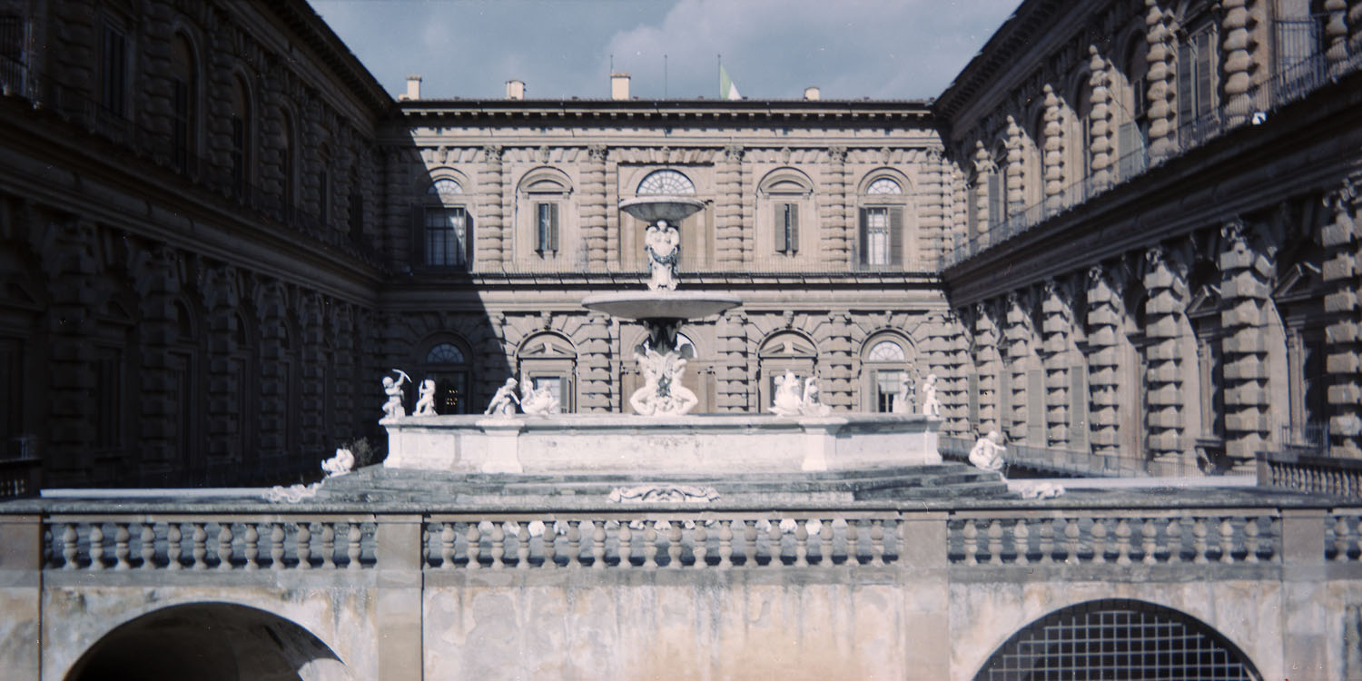
The next day, we met up again and walked over to the Palazzo Pitti via the Ponte Vecchio. The Palazzo Pitti is gargantuan – it was the Medici family’s main residence in the 16th and 17th centuries, and everything about it was designed to overawe. The Vasari corridor connects it with the Uffizi over the Ponte Vecchio to provide a secure passage should the Medicis need to escape an angry mob, or just not want to mingle with the hoi polloi on their way to and from their private box seats at the Santa Felicita church.

Cyclist, Palazzo Pitti

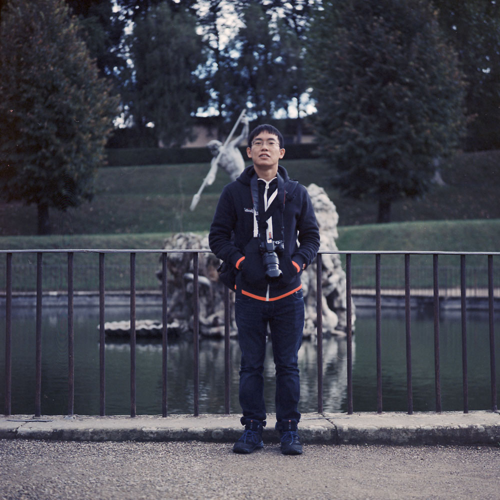
The Boboli Gardens back onto the Palazzo Pitti. They were once the private playground of the Medici family, but now are open to the public. This is the garden facade of the Palazzo Pitti.

Pitti Palace, from the Boboli Gardens

After touring through the Pitti and hiking up and down the Boboli gardens (which are on the face of a fairly steep hill), TC and I grabbed lunch at a little cafe across from the Palazzo Pitti’s main entrance. I had my first ever cappuccino there. I’m now a devotee, provided there’s enough sugar.

So thank you, TC, for the Benadryl, the companionship, and for the swiss chocolates – they were delicious!

Tiber Panorama, from Castel Sant’Angelo

Tiber Panorama
Tiber Panorama

This is a panorama I took of the bend in the Tiber river just in front of the Castel Sant’Angelo, from the castle’s ramparts. St. Peter’s is to the right, out of view. If you look at the bridge in the background, you can see the keyhole arches in the supporting piers which are there to help the bridge not get washed away in time of flooding. There are a number of bridges across the Tiber with this feature, including the famous “Ponte Rotto” (Broken Bridge), which you’ll see in some other shots I’ll post later.

This was taken with my Belair X6-12 camera. As you can see, it’s a pretty soft lens, combined with what was probably a pretty slow shutter speed (1/30th, 1/15th? with this camera, who knows- it sets it automatically for you and doesn’t tell you what it used). But it has a look to it, and the negative isn’t unusable.

Urban Landscape – Rock Creek Park

Rock Creek Park is a large urban park that runs from where Rock Creek enters the Potomac River to its headwaters some 30 miles away in central Maryland. Part of that park is owned and operated by the United States Park Service, and part is a regional park operated by Montgomery County, Maryland. The park dates to the 1890s and was surveyed by Frederick Law Olmsted, the famous landscape designer. In one of the greenest cities (Washington DC has more tree coverage than any other major US city, earning it the nickname “the tree capital of the US” and making it a living hell twice a year for allergy sufferers), it is a natural oasis of wild landscape. It was not always so, as Rock Creek provided the power to dozens of mills that functioned as the industrial engine such as it was for Washington and its surrounding farmland. Today, Pierce Mill is one of the few remaining complete structures to commemorate that industrial heritage. If you take a wander up the trails that parallel the stream, though, you can find signs of some of the other mills that dotted the landscape.

This structure marks the remnants of one of the larger mills along Rock Creek. I’d have to go back and take notes on the signage along the path that indicates what this mill produced and who owned it and when it operated, but most likely it ceased to function in the 19th century. To require such large foundations, it must have been a substantial operation, though.

Mill Foundations, Rock Creek

Here is the footing for a small bridge that spanned the creek.

Bridge Footing, Rock Creek

Somewhat more modern evidence of the urbanization of Rock Creek, a road bridge that spans the creek and provides access to the park from the neighborhoods around it.

Bridge over Rock Creek

A gravelly bend in the creek, dappled with sunlight. Hard to imagine that within 200 yards of either side of this stream there are roads, houses, cars and businesses.

Gravelly Bend, Rock Creek

A tree along the trail that follows the stream.

Shaggy Bark, Rock Creek

And a final reminder of man’s presence – an electrical junction box. It has the feel of being a monolith, left behind by an alien civilization, purpose unknown, long abandoned, or a portal to another place and time like the wardrobe portal to Narnia.

Monolith, Rock Creek Park

Monocacy Battlefield – The Farms – Best Farm

The Best farm is the largest remaining property on the battlefield at Monocacy. The original property was 750 acres, today it retains 270-some. The property was owned by a white family who immigrated from Santo Domingo (now Haiti) at the beginning of the 19th century, fleeing political and social unrest after the slave rebellion on the island. They re-established their plantation outside Frederick, Maryland, which they named L’Hermitage. The landowners who established the farm had 90 slaves, an unusually large number for a property of its size, and they were the second-largest holding of slaves in the county. According to the Park Service website, one theory has it that they were trying to replicate the slave-labor system they were used to in Haiti, and had that many slaves as part of a rental scheme where they would rent them out to neighboring farmers. On my tour, it was mentioned several times that recent evidence has come to light that the farm operation included the breeding of slaves like racehorses for sale.

The main house is quite large, bigger even than the Thomas farm house. Like the Thomas and Worthington homes, it is not open for tours. The interior is in quite rough shape, but stable. Perhaps one day they will be able to restore it and re-open the home for interpretive tours. The farm was privately operated until 1993 when the park service acquired it. The house was not occupied during the later years of farm operation, though, judging from the condition visible through the windows. If I recall correctly the last occupant of the home was a relative of former Senator Mac Mathias. I wonder if she knew the full history of her property – I don’t know how comfortable I would feel living in a house, no matter how lovely, that was built on the profits from the sale of human beings.

Big House, Best Farm

I originally thought this structure was the summer kitchen. In fact, it was a secondary home on the property. It was furnished with plaster walls with decorative motifs, much to the same standard as the main house. It is thought that the structure was built to support other French refugees from Haiti and the French Revolution who were relatives or friends of the family. There would have been a porch with stairs on this side facing the house to provide access. The row of slave cabins would have been between this structure and the main road. If they were still standing, they would be visible in the background of this scene.

Secondary House, Best Farm

Here is a view of the stone barn as seen from inside the corn crib. I remember seeing this barn from the interstate highway as we would drive past every weekend when I was a child, and wanting to go see it up close. I had no idea then of the history of the property. The roof of the barn is of course not original, but the stone walls themselves date to 1798 when they were mentioned in the tax assessment. It is an unusual structure in its design, and looks and feels more like a French or English country barn from the 18th century than an American barn structure.

Stone Barn, Best Farm

A view of the corn crib.

Best Farm Corn Crib End

The reason the farm is called the Best farm is that it was leased for operation by the Best family from 1864 until 1993. It was owned, however, by the Trail family, which has provoked a friendly dispute between Ed Bearss and the Park Service staff because he still wants them to call it the Trail farm, not the Best farm.

Monocacy Battlefield – The Farms – Worthington Farm

Views of the Worthington House. This house was the center of a smaller farm operation (relative to its neighbors, at roughly 300 acres) through which the Monocacy battle transpired. Rebel forces had crossed the Monocacy river at a ford adjacent to this property, and set up an artillery position near the house, from which they could see not only the Thomas house, but the Union positions at the railroad junction perhaps a mile or so away. Throughout the battle, the Worthington family took shelter in their basement, and their six year old son watched the battle through the gaps in a boarded-up window. He would later publish a book about his experience.

This louvered window is most likely the window through which young Glenn Worthington witnessed the battle, as it has the best views across the property where the Rebel units would have positioned themselves.

Basement Window, Worthington House

A detail shot of the front door to the Worthington house

Worthington House Door

A view off the front porch, including the lawn where the Rebel forces took up position.

Worthington House Front Window

a view looking down the length of the front porch. This is very much like the front porch that would have been on the Thomas house.

Worthington House Front Porch

I did take a view of the whole Worthington house front, but something went wrong with the negative and I don’t feel like spending several hours in Photoshop cleaning it up and trying to fix it. I’ll save it for another day and go back and re-photograph it.

Monocacy Battlefield – The Farms – Thomas Farm

The Monocacy Battlefield National Park consists primarily of three farm properties, the Worthington, Thomas and Best farm properties. I’ll cover the Worthington house in a second post. What makes this special is the extent of original preservation of those three homes which were on the battlefield at the time of the fight, and in relatively original condition, with the same outbuildings and dependencies that were on the properties. You go to visit Monocacy, and you’re seeing nearly exactly what the Union and Confederates saw 150 years ago, although with more trees.

The Thomas farm had a large manor house on the property owned by a wealthy gentleman farmer from Baltimore who had acquired the property as a country home to escape the heat and humidity of the big city.

Thomas Farm House
Thomas Farm House

Changes made to houses always leave signs. The face of this house used to have a porch that spanned the width of the house, on both the first and second floors, and the second story windows were once full-length doors like the first floor windows. These would have been very useful in the days before central air conditioning to help catch a breeze in the summer. Also, the third story dormer windows are most likely 20th century additions, as is the decorative arch over the front door. The house itself was occupied by private owners into the 1960s at least, and now is used by the Park Service for meetings. While you cannot tour inside the house, the interior is in stable if not terribly original condition, which you can see through the windows.

The grand allee out front leads down to the Georgetown Pike (today known as Route 355 or Rockville Pike). It may have been a bit less dense in 1864, but it would have looked generally similar at that time. What a wonderful way to approach your home, isn’t it?

Thomas House Allee
Thomas House Allee

The Thomas farm is still a working farm – they have a herd of cattle, and crops are planted and harvested out of the fields. The barn itself is the same structure that was present in 1864 at the battle. The round silo is NOT original, as round silos did not show up until the first decade of the 20th century.

Thomas Farm Barn
Thomas Farm Barn

Another view of the silo.

Silo, Thomas Farm Barn

Towards Emmitsburg, Maryland

I’m not normally a landscape photographer. In a conversation on Facebook, I had posted this image and said that I didn’t normally think of the Rolleiflex as a landscape camera, mostly because that’s not the way I use it (street scenes, portraiture and architecture are what I shoot 99% of the time). Several people responded that it is a great landscape camera, and they’re right- no general-purpose camera is defined by/limited to one specific genre. I wouldn’t try and shoot landscapes with a Yashica Dental Eye, but it’s an extreme example of a specialist camera built to do one thing and one thing only. A Rolleiflex is NOT a Dental Eye, so it can, and does, do perfectly serviceable landscapes. In fact, as with most things photographic, the limiter is the operator of the camera, not the device itself.

This is a winter landscape, looking from a rest stop along Route 15 toward Emmitsburg, Maryland. If you look carefully, you’ll see two church steeples peeking over the tree line in the middle distant background. While I don’t know that those specific churches were there at the time of the Civil War, the landscape still looks and feels much as it would have in 1863 as soldiers marched to and from the Battle of Gettysburg, a scant 14 miles away.

Towards Thurmont
Towards Emmitsburg

I had someone else comment that the image looks “washed out”, and asked if I was using outdated film. No, I’m using in-date film, properly processed. It’s a winter landscape, with just a few tones in the scene, and a color palette of grays and browns. That’s pretty much exactly how it looked that evening.

Winter Thistles
Winter Thistles

These thistles were part of the field you can see on the near edge of the pond. I saw the sun backlighting them and got up close to give them that silhouetted rim-light, with the lens flare from the sun coming directly into the lens. It would have been nice to actually get MORE lens flare, but that’s a testament to the lens design that it doesn’t.