Another regular subject for me is bicycles and public transportation. Here are four more bicycle photos seen around town.
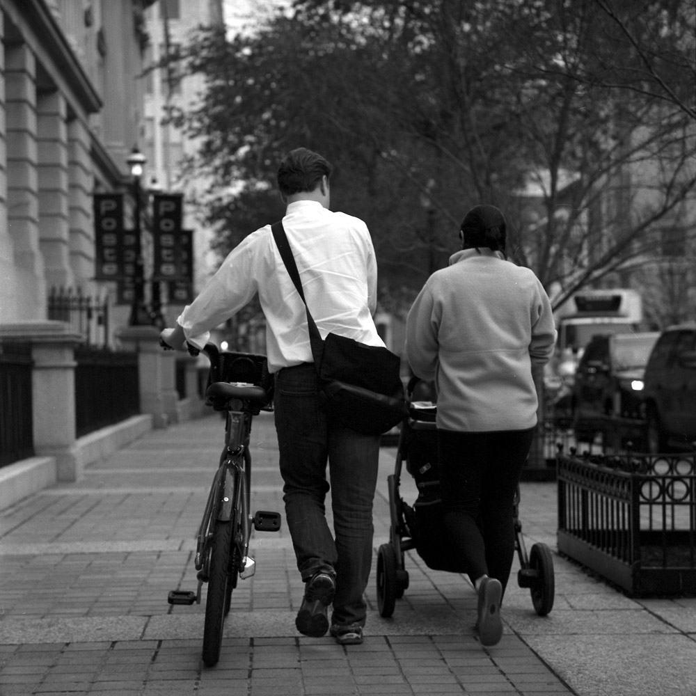
A couple walking home together. He’s using a Bikeshare bike, which is a pretty positive commentary on their adoption by more than just tourists.
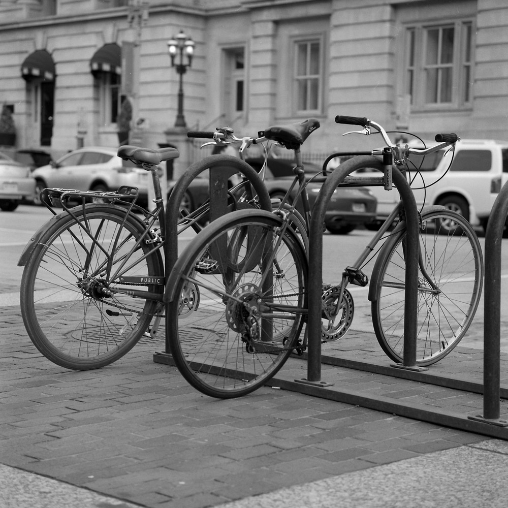
A pair of interesting old bikes locked up on the rack outside the National Portrait Gallery/American Art Museum.
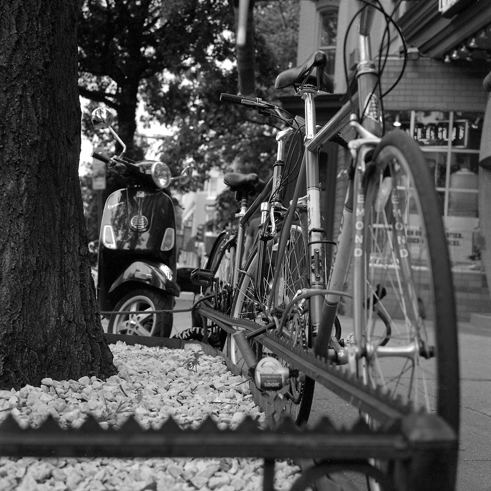
I’m on the fence about how much I really like this image, but it’s bikes, so I’m including it for now. Let me know what you think – does the composition work well? Placement of depth-of-field?
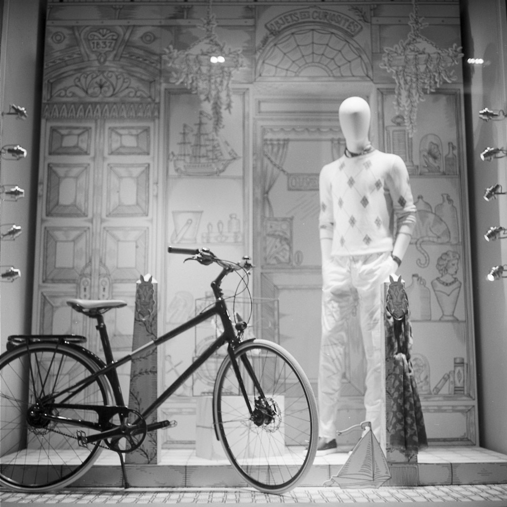
Finally, the bike in the Hermes window. While it’s not in use for its intended purpose, it’s a nice looking bike, and it’s in the Hermes store window, very cleverly employed in the window design. I forget if it was red or dark blue (I think red), but it was a splash of color that popped out against the white backdrop of the window, pulling your eye around the display.
Here’s another photo of Ed Bearss I took on the Ball’s Bluff tour, as he’s describing the battle in front of the sign at the park entrance, armed with one of his US Marine Corps- themed swagger sticks.

He’s always carrying one to point and gesture with while he talks, for emphasis.
Another stop on the tour I did with Ed Bearss earlier this month was the battlefield of Ball’s Bluff. Ball’s Bluff was a very significant early battle in the Civil War – while in the grand scheme of things a minor engagement with a total of three hundred or so Union casualties (including drowning deaths of soldiers trying to escape the Rebel onslaught across the Potomac River, swollen with recent rainwater), the Union loss and its aftermath (bodies of soldiers who drowned fleeing the battle washed up in Washington DC and as far south as Fort Washington, some 60 miles downriver) were shocking enough that they triggered the formation of a joint committee comprised of senators and congressmen, the Committee on the Conduct of the War. This oversight committee was empowered to investigate not only the military but the executive branch up to and including the President himself.
Today, while the cemetery itself is administered by the Veterans’ Administration and is a National Military Cemetery, the parkland surrounding it is not US Park Service property but instead is a joint program of local and regional governments and non-profits. There is a 1970s subdivision built right up against its southern edge, which you have to drive through to get to the park.
This is a view down Ball’s Bluff – some three hundred feet tall, you can see the river as a bright patch in the lower center of the image. Many of the Union casualties were chased down this cliff face by charging Rebel soldiers and plunged to their deaths. The photo doesn’t do justice to the steepness of the cliff face – that would be a truly terrifying predicament – leap or fall over the edge to break your neck if you’re lucky, or get shot.
Here is the gate to the cemetery – one of the smallest in the National Military Cemetery system. Fifty-four are buried, with twenty-five markers. Only one is known. The cemetery is closed to new burials, for rather obvious reasons. There are two markers outside the cemetery where a Union commander, Col. Edward Baker, and a Southern infantryman, Clinton Hatcher, were killed, but neither are interred in the cemetery or within the park.
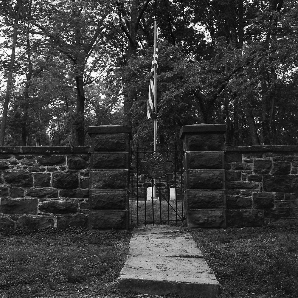
The cemetery itself is a very simple design, with the headstones laid out in a semi-circle around a flagpole, enclosed by a wall of Seneca sandstone, the same stone used to build the Smithsonian Castle.
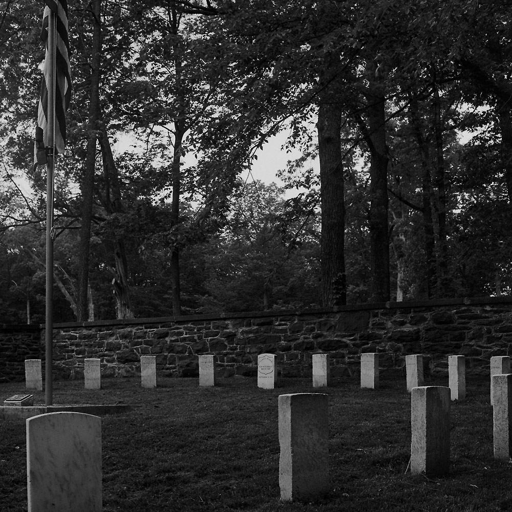
A close-up of one of the headstones for the unknown dead buried within.

This in a way closes a loop in my antique image collecting. While I don’t actively seek out Civil War soldier images, as they are highly sought after and very expensive, especially when the subject is identified, the graves of the unknown soldiers are a reminder of why so many soldiers at the time had their portraits made. Not only to send home to loved ones out of pride in their profession, but to help provide a means of identification should they be killed in battle, in a day when the dog tag had not been invented, nor DNA profiling or even dental records. Today, the unknown soldier is almost impossible, but back then, an all too frequent reality. When you were killed on the battlefield without any form of ID, and the battle lasted for several days, and your body lay in the sun as it ripened and rotted, and maybe there was no good way to get your body back to civilization at the time of the battle, you could end up not buried, or just dumped in a shallow grave for sometimes years. There are photos of burial parties at Cold Harbor where formerly enslaved black men are collecting remains for inclusion in the cemetery, and they have a cart full of skeletons.
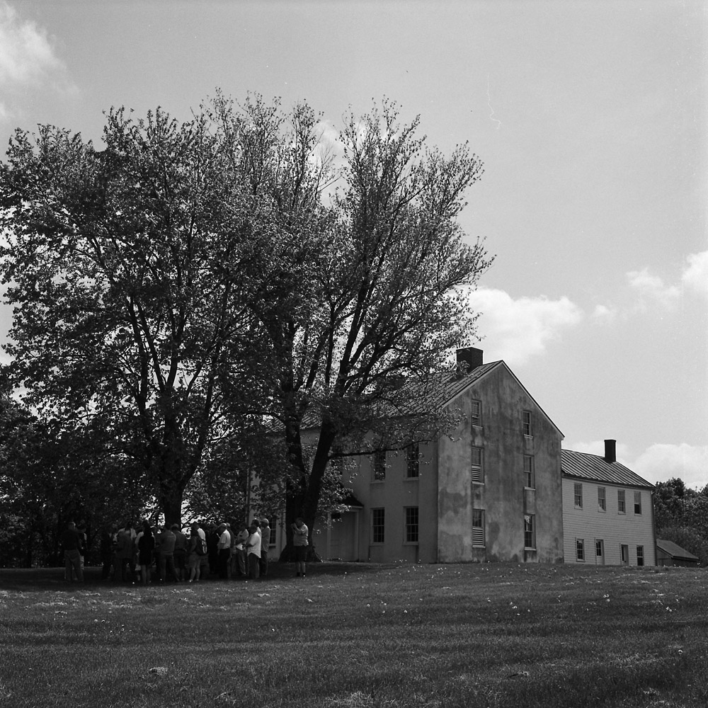
The Best farm is the largest remaining property on the battlefield at Monocacy. The original property was 750 acres, today it retains 270-some. The property was owned by a white family who immigrated from Santo Domingo (now Haiti) at the beginning of the 19th century, fleeing political and social unrest after the slave rebellion on the island. They re-established their plantation outside Frederick, Maryland, which they named L’Hermitage. The landowners who established the farm had 90 slaves, an unusually large number for a property of its size, and they were the second-largest holding of slaves in the county. According to the Park Service website, one theory has it that they were trying to replicate the slave-labor system they were used to in Haiti, and had that many slaves as part of a rental scheme where they would rent them out to neighboring farmers. On my tour, it was mentioned several times that recent evidence has come to light that the farm operation included the breeding of slaves like racehorses for sale.
The main house is quite large, bigger even than the Thomas farm house. Like the Thomas and Worthington homes, it is not open for tours. The interior is in quite rough shape, but stable. Perhaps one day they will be able to restore it and re-open the home for interpretive tours. The farm was privately operated until 1993 when the park service acquired it. The house was not occupied during the later years of farm operation, though, judging from the condition visible through the windows. If I recall correctly the last occupant of the home was a relative of former Senator Mac Mathias. I wonder if she knew the full history of her property – I don’t know how comfortable I would feel living in a house, no matter how lovely, that was built on the profits from the sale of human beings.
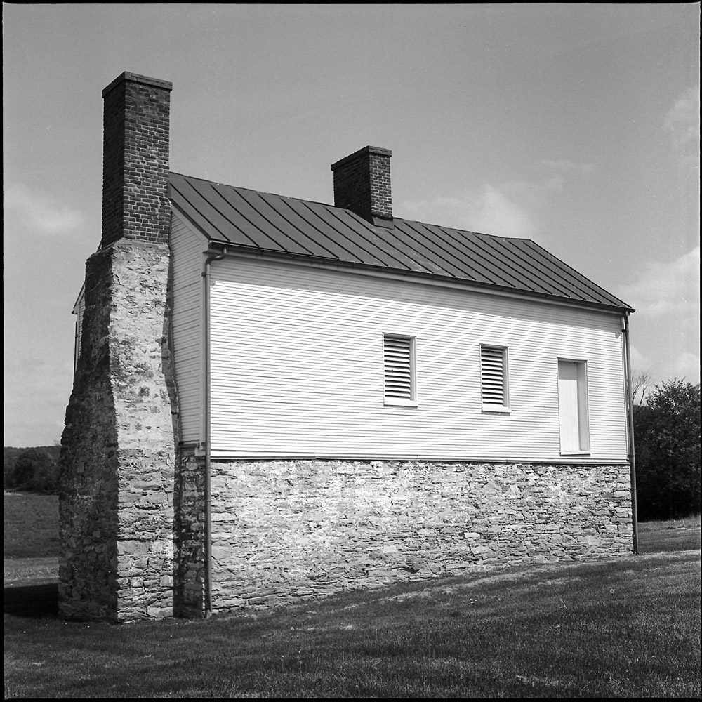
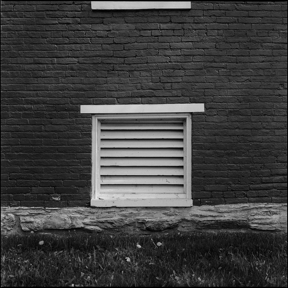
I originally thought this structure was the summer kitchen. In fact, it was a secondary home on the property. It was furnished with plaster walls with decorative motifs, much to the same standard as the main house. It is thought that the structure was built to support other French refugees from Haiti and the French Revolution who were relatives or friends of the family. There would have been a porch with stairs on this side facing the house to provide access. The row of slave cabins would have been between this structure and the main road. If they were still standing, they would be visible in the background of this scene.
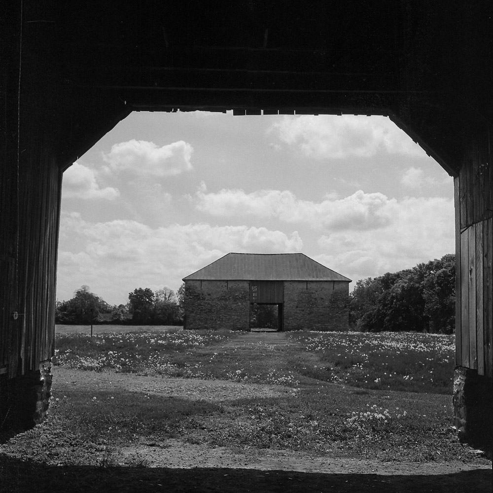
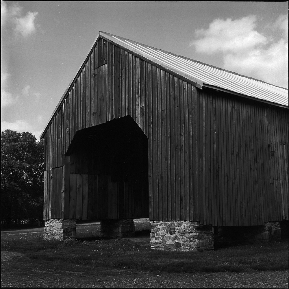
Here is a view of the stone barn as seen from inside the corn crib. I remember seeing this barn from the interstate highway as we would drive past every weekend when I was a child, and wanting to go see it up close. I had no idea then of the history of the property. The roof of the barn is of course not original, but the stone walls themselves date to 1798 when they were mentioned in the tax assessment. It is an unusual structure in its design, and looks and feels more like a French or English country barn from the 18th century than an American barn structure.
A view of the corn crib.
The reason the farm is called the Best farm is that it was leased for operation by the Best family from 1864 until 1993. It was owned, however, by the Trail family, which has provoked a friendly dispute between Ed Bearss and the Park Service staff because he still wants them to call it the Trail farm, not the Best farm.
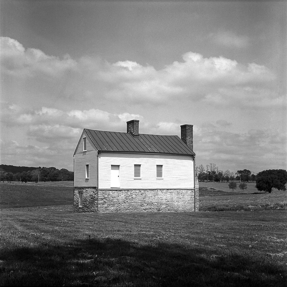
Views of the Worthington House. This house was the center of a smaller farm operation (relative to its neighbors, at roughly 300 acres) through which the Monocacy battle transpired. Rebel forces had crossed the Monocacy river at a ford adjacent to this property, and set up an artillery position near the house, from which they could see not only the Thomas house, but the Union positions at the railroad junction perhaps a mile or so away. Throughout the battle, the Worthington family took shelter in their basement, and their six year old son watched the battle through the gaps in a boarded-up window. He would later publish a book about his experience.
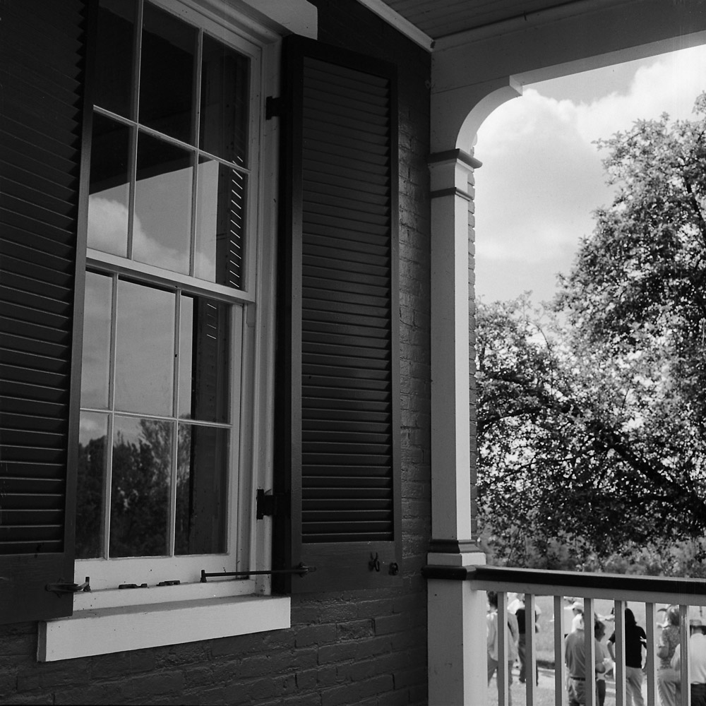
This louvered window is most likely the window through which young Glenn Worthington witnessed the battle, as it has the best views across the property where the Rebel units would have positioned themselves.
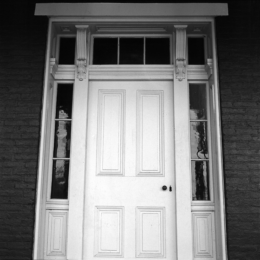
A detail shot of the front door to the Worthington house
A view off the front porch, including the lawn where the Rebel forces took up position.
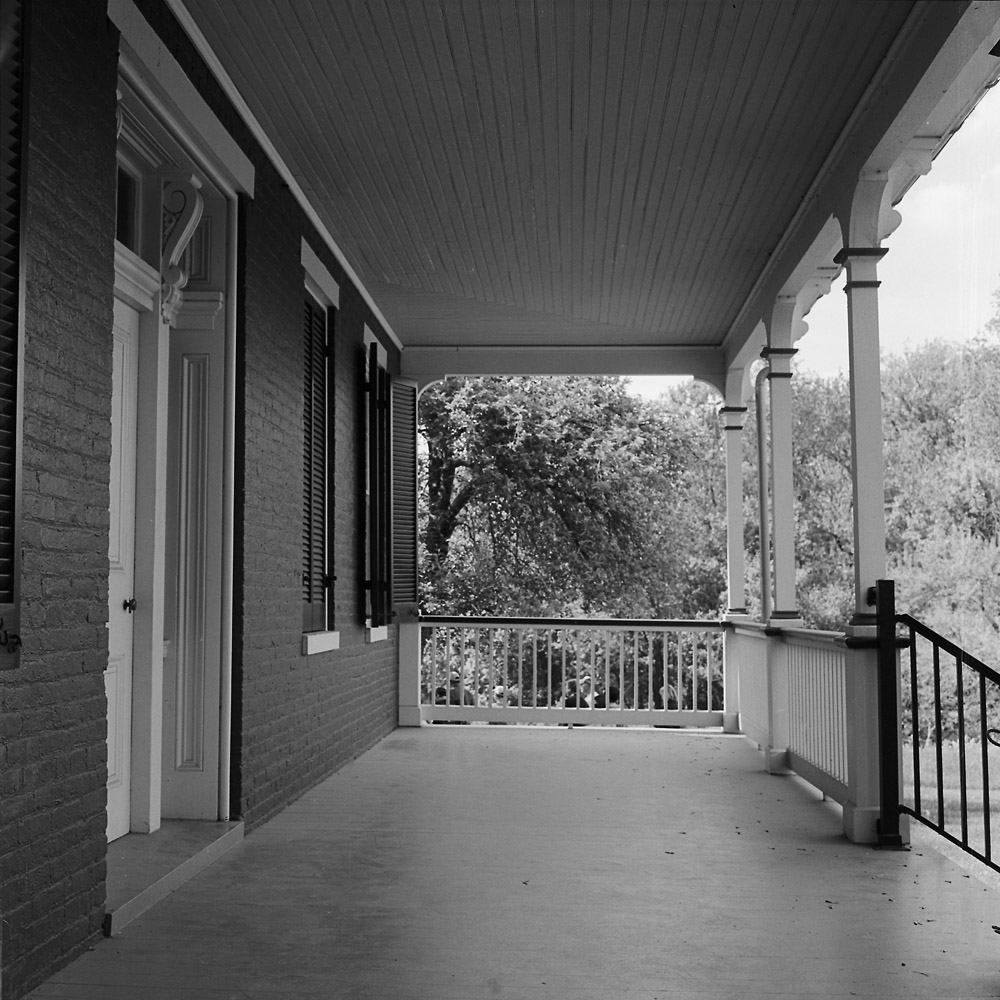
a view looking down the length of the front porch. This is very much like the front porch that would have been on the Thomas house.
I did take a view of the whole Worthington house front, but something went wrong with the negative and I don’t feel like spending several hours in Photoshop cleaning it up and trying to fix it. I’ll save it for another day and go back and re-photograph it.
The Monocacy Battlefield National Park consists primarily of three farm properties, the Worthington, Thomas and Best farm properties. I’ll cover the Worthington house in a second post. What makes this special is the extent of original preservation of those three homes which were on the battlefield at the time of the fight, and in relatively original condition, with the same outbuildings and dependencies that were on the properties. You go to visit Monocacy, and you’re seeing nearly exactly what the Union and Confederates saw 150 years ago, although with more trees.
The Thomas farm had a large manor house on the property owned by a wealthy gentleman farmer from Baltimore who had acquired the property as a country home to escape the heat and humidity of the big city.
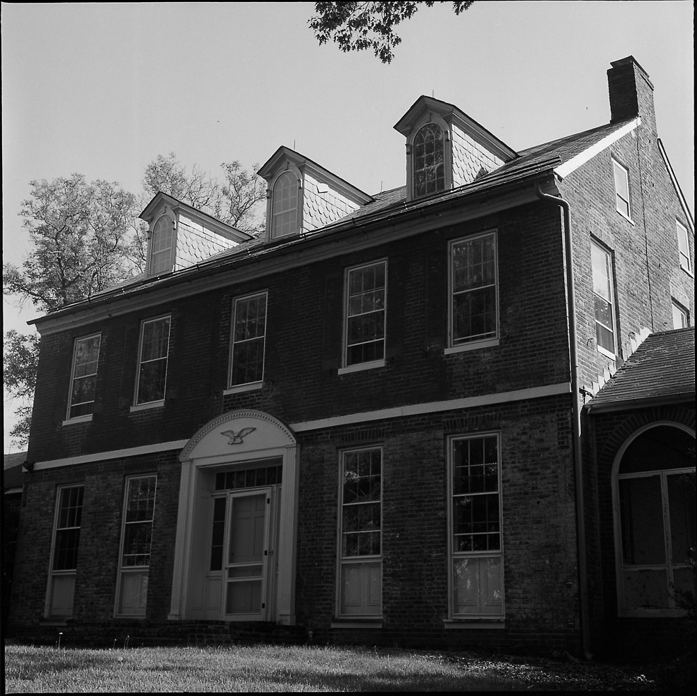
Changes made to houses always leave signs. The face of this house used to have a porch that spanned the width of the house, on both the first and second floors, and the second story windows were once full-length doors like the first floor windows. These would have been very useful in the days before central air conditioning to help catch a breeze in the summer. Also, the third story dormer windows are most likely 20th century additions, as is the decorative arch over the front door. The house itself was occupied by private owners into the 1960s at least, and now is used by the Park Service for meetings. While you cannot tour inside the house, the interior is in stable if not terribly original condition, which you can see through the windows.
The grand allee out front leads down to the Georgetown Pike (today known as Route 355 or Rockville Pike). It may have been a bit less dense in 1864, but it would have looked generally similar at that time. What a wonderful way to approach your home, isn’t it?
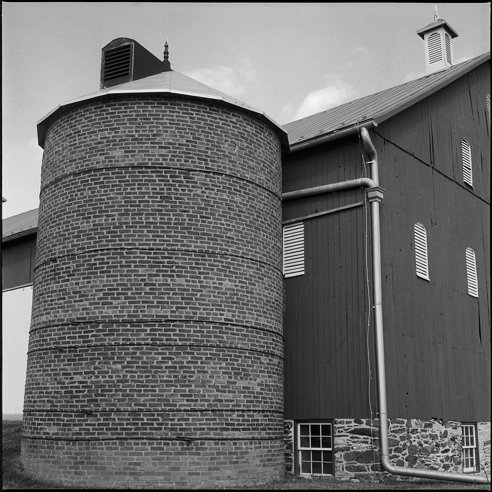
The Thomas farm is still a working farm – they have a herd of cattle, and crops are planted and harvested out of the fields. The barn itself is the same structure that was present in 1864 at the battle. The round silo is NOT original, as round silos did not show up until the first decade of the 20th century.
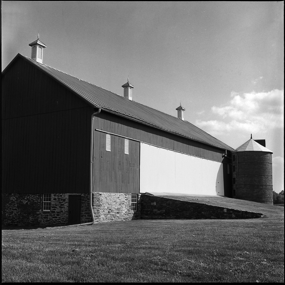
Another view of the silo.
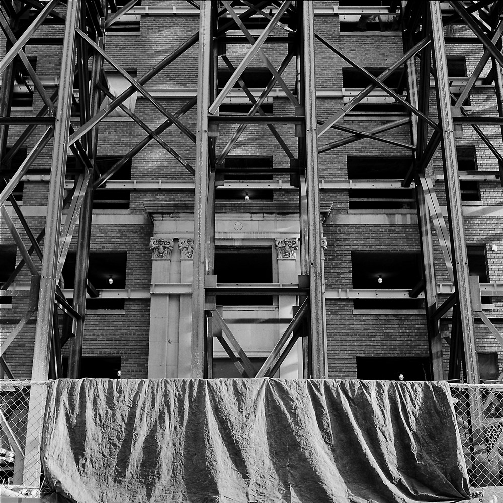
If there’s one subject that never fails, it’s architecture. Twenty-four hours a day, it looks different. To the patient and observant eye, even the most seemingly bland box of a building can be transformed into a study of volume and texture with the careful observation and application of light.
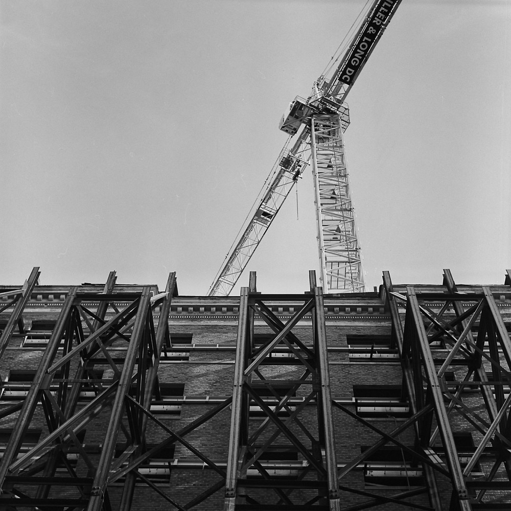
Steel girders wrapping a facade for protection during renovation become a study of patterns and of contrasting textures – the rigid linearity and modernity of the I-beams highlights in strong relief the delicate brickwork and moldings behind it, and the strong shadows cast by the evening sun bring out geometric repetition.
The white crane above the girder wall catches the late afternoon sun, a thrusting line that divides the blank sky with dynamic movement that creates multiple negative spaces instead of unbalancing the image with empty information.
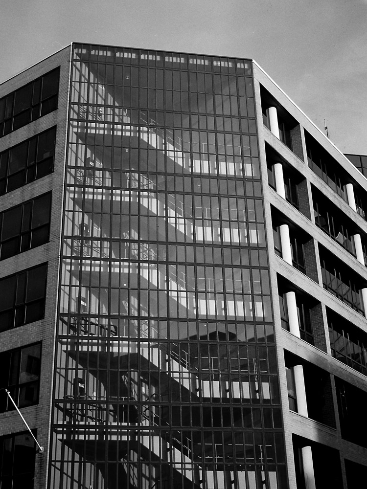
This image would be even better in color as there are patches of blue in the stairwell that repeat in a subtle pattern, drawing your eye into and up the stairs, but even in black-and-white, the repeated lines of the ascending structure draw your eye through the image.
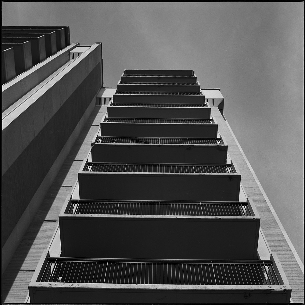
I like the vertiginous vertical lines of the apartment tower as you look straight up it. Believe it or not this was shot hand-held, no tripod, no level, just very careful eyeballing and steady hands.
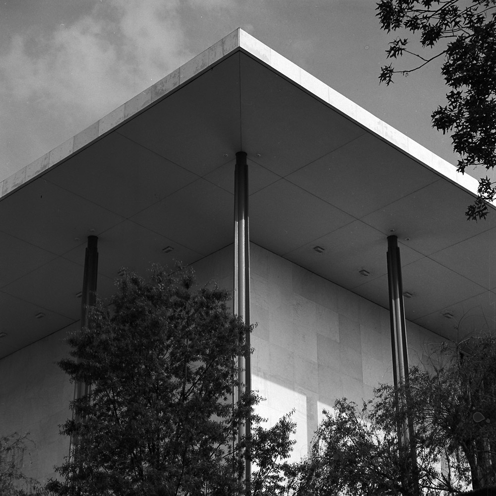
The Kennedy Center for the Performing Arts is a magnificent slab of white marble. Even the outside spaces are all grand and awe-inspiring, very much in keeping with the goal of presenting and preserving the performing arts. Here the roofline is a dramatic act in itself, like a set piece in an opera playing on the stage within. Wagner couldn’t have composed it better.
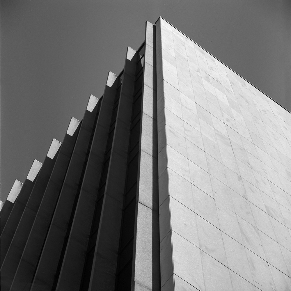
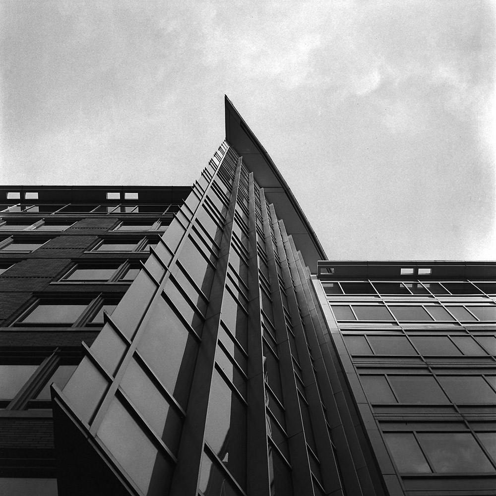
Another vertigo-inducing shot looking straight up at what I call the ships’ prow building. The facade is mostly flat, but this arced wedge bursts forth from the surface like a ship’s prow cutting the waves.
Three random people shots from out and about.
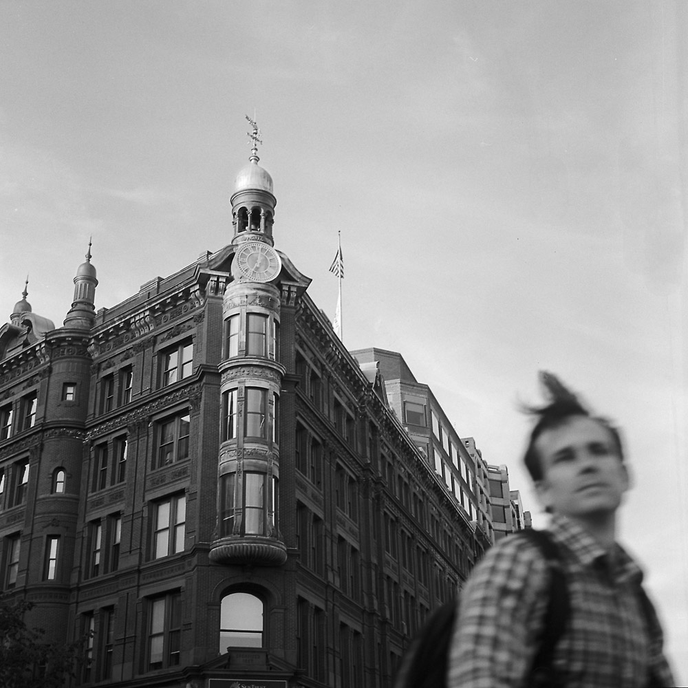
While this shot is at least as much about the SunTrust Bank building in the background, I love how the cyclist passing through the shot turned out – he’s obviously in motion, with a lock of hair blown up and back as he moves. The blurred face makes it somewhat anonymous, an everyman on his way somewhere quickly, turning his head just long enough to look back at the camera looking at him. Actually kind of a rarity these days.
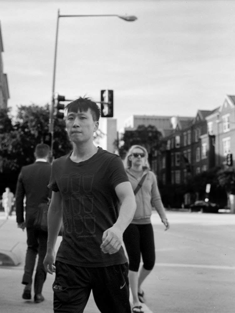
I liked the graphic design of his t-shirt so I set up my camera before he started crossing the street and waited until he was in “the zone” to snap the picture. He’s not tack-sharp because we were both moving at the time, but I think the slight softness of him and the people around him give a sense of movement as well as depth.
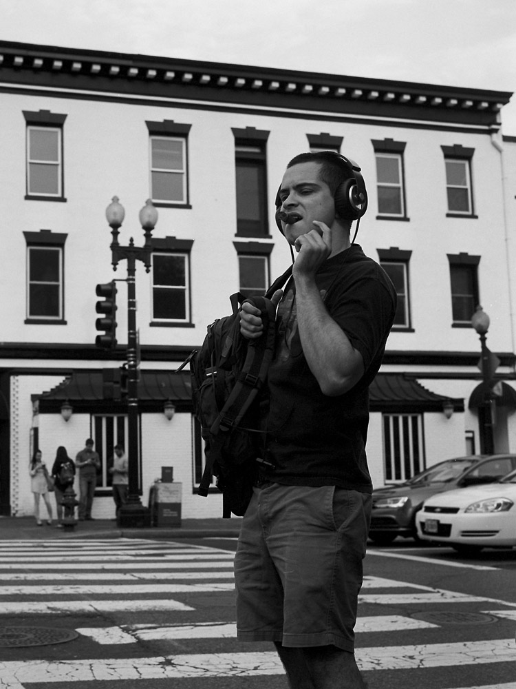
When I saw this character I had to photograph him – giant headphones combined with the fat stogie? How could you NOT?
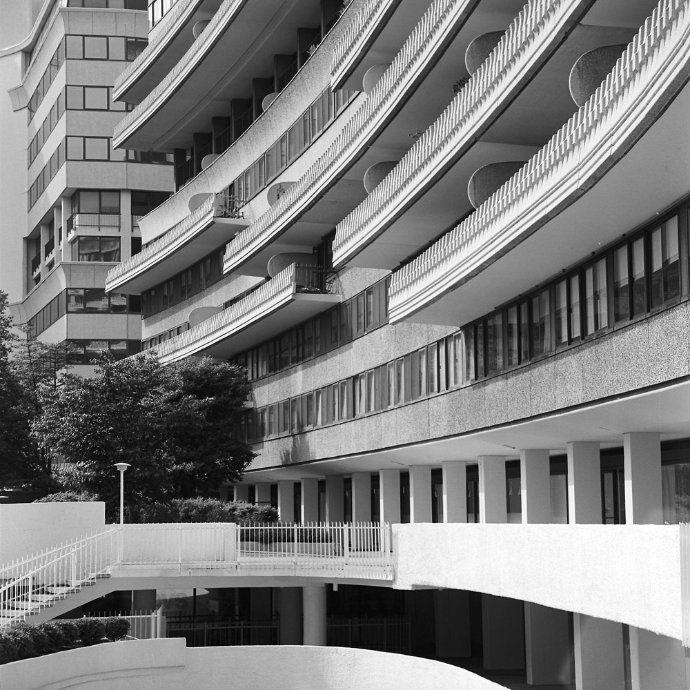
Given the looming Watergate break-in anniversary in June, I thought it apropos to post some images of the historic complex to let folks get an idea of what the place looks like. The name itself is so iconic, so much larger-than-life, I think it tends to overwhelm all thoughts of what the place actually is. This was not some garden-variety office tower. Even back-in-the-day, this was a very high-end residential, hotel and office complex, with views of the Potomac River, Georgetown and the Kennedy Center. It is across the street from the Saudi Embassy and a scant several blocks to the State Department headquarters. The place positively reeks of old money – it’s quiet as a tomb at all hours of the day and night.
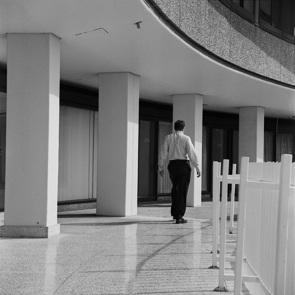
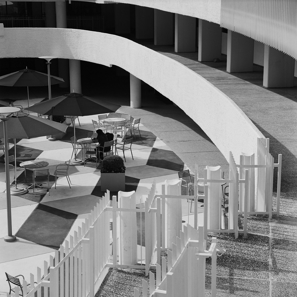
There are people around, as you can see in the image above, but they never seem to be coming or going in groups, or with any volume. Spaces where you’d expect to see lots of people, like around the fountain, or in the courtyard, are usually very quiet.
I’m particularly pleased at how well the first fountain shot turned out because of the white-on-white challenge. I was able to photograph it so that the white stayed bright but retained detail. It’s kind of like the egg challenge often assigned in studio photography classes – put an egg on a white backdrop and photograph the egg so the shell texture retains detail but is still white.
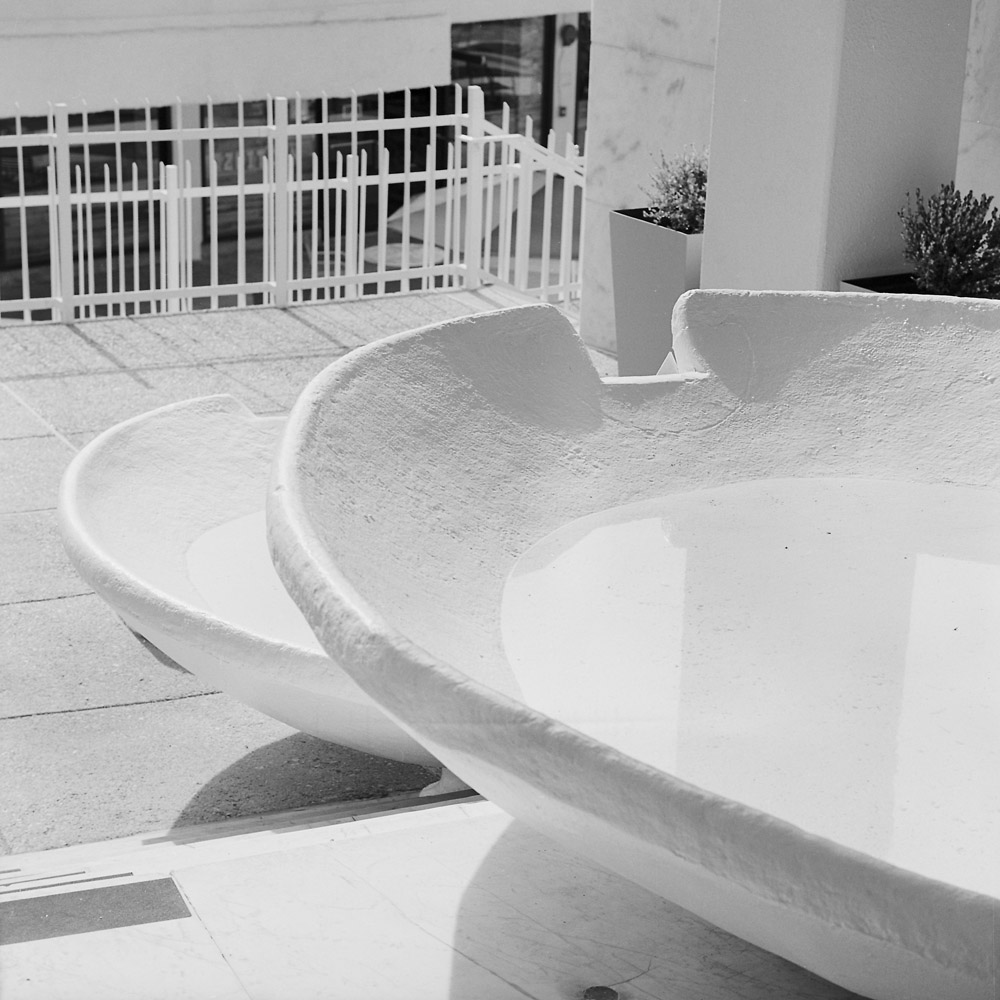
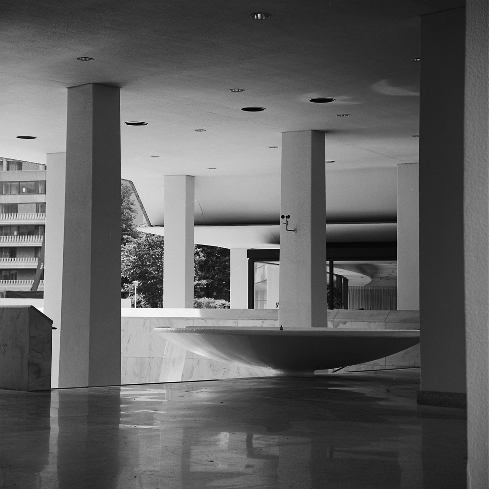
A very different mood for the same subject, just by changing the camera position and therefore the lighting on the subject.
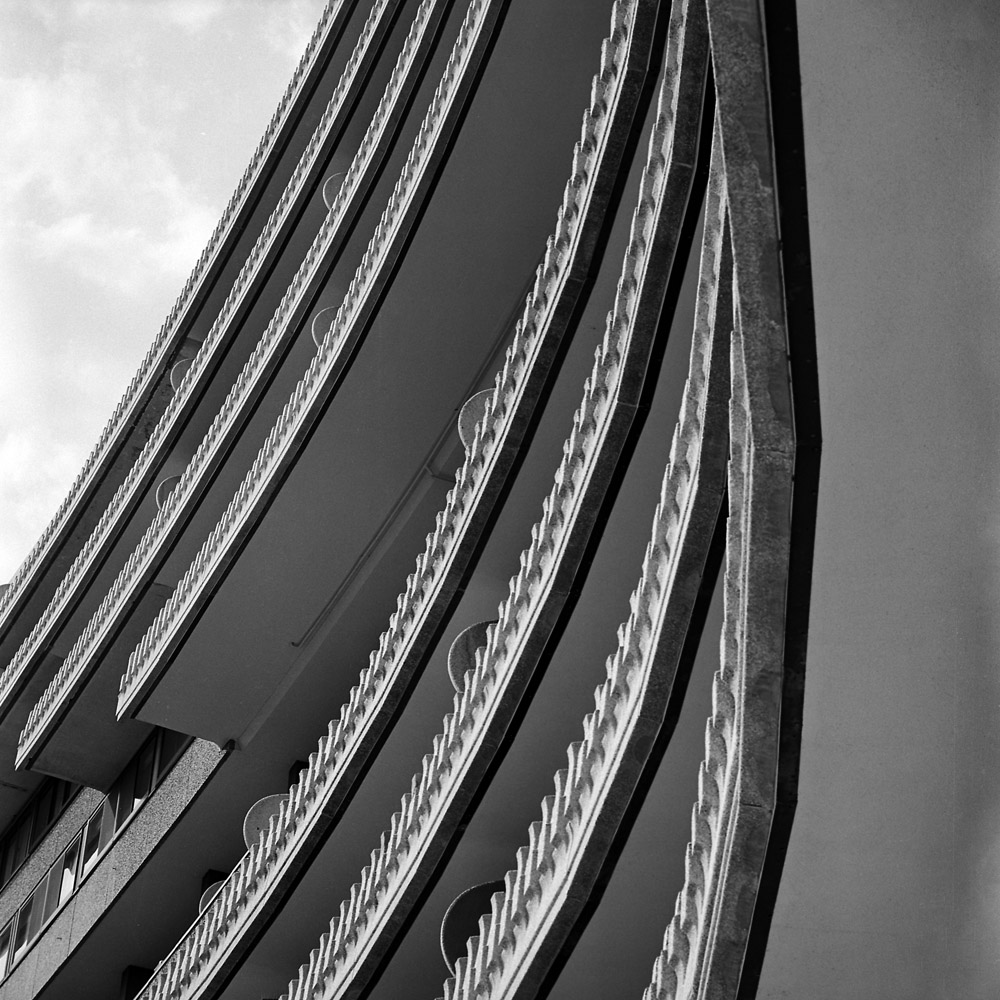
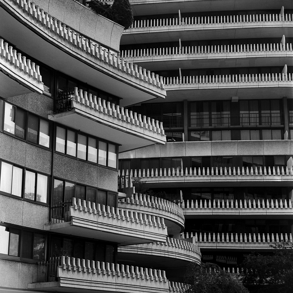
I love the balconies on the Watergate complex – they wrap around it in undulating curves and add texture to what would otherwise be an extremely plain building. Seen from a distance, as a colleague of mine put it, the Watergate does look a bit like a cruise ship the 1960s forgot.
Another view of the courtyard. Again, just one person sitting alone at a table. There’s a restaurant down there, believe it or not.
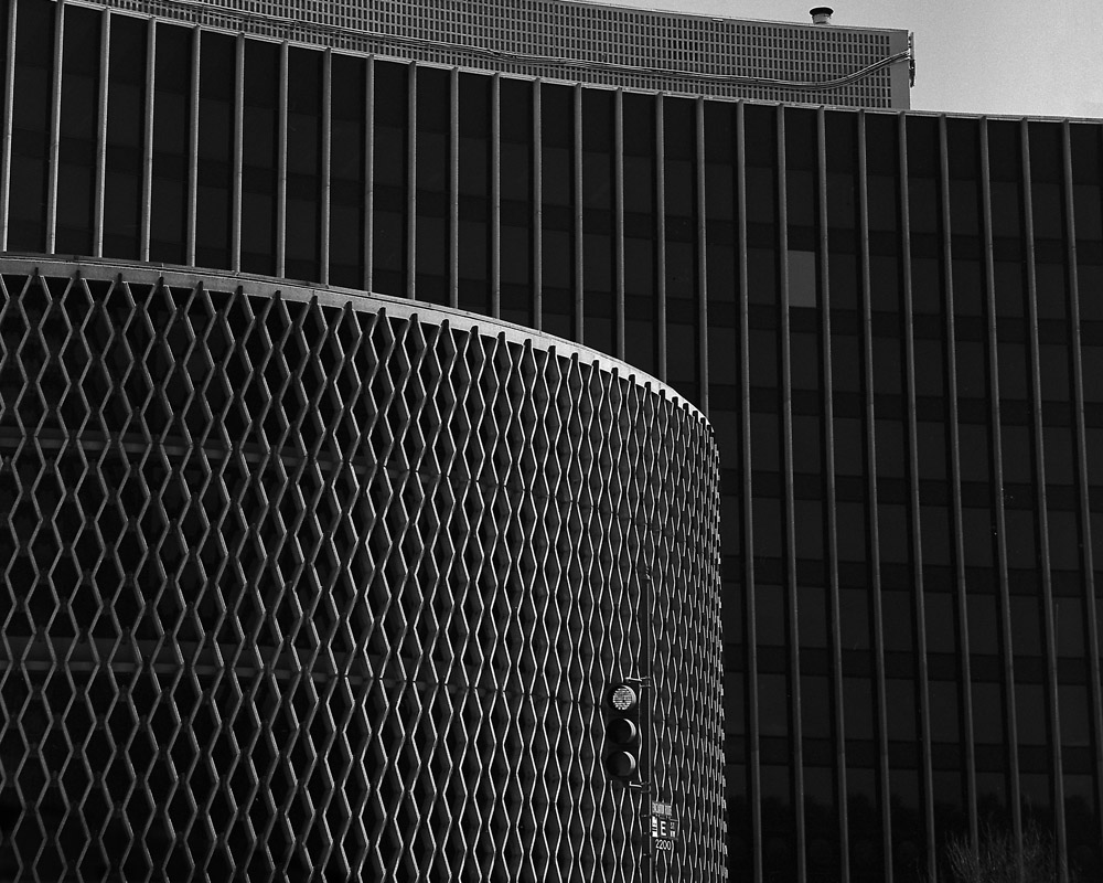
The Watergate is a great place to practice architectural abstraction because of its size, shape and textures. This view feels like a whole bunch of zippers fanning out in a display.